Mãe-da-Lua Reserve
Our RPPN (private reserve) is located in the municipality of Itapajé in the state of Ceará, about half way between the capital Fortaleza and Sobral. It includes the east and north sides of a low mountain range called "Serra das Vertentes" (about 400 ha) and lowland south of the mountains (about 360 ha). See fig. 1.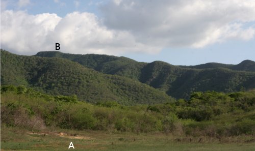
The maximum elevation of the mountain range is 650-700 m.
Large parts of the property were covered by cotton plantations until about 1970. The cotton areas included the lowland and easily accessible hillsides, but did not extend into areas of more difficult access, like steep hillsides and mountain tops. On one of the mountains existed a banana plantation, which was abandoned in the late sixties or early seventies.
From the 70ties onwards, the farm was used mainly for grazing cattle in native pasture (i.e. in caatinga) and for slash-and-burn subsistence agriculture. The areas of difficult access and some of the former cotton areas were left to themselves.
The non-profit group "Associação Mãe-da-Lua" bought the land in 2006 and has transformed it into a nature reserve. Flora and fauna are now protected and hunting is forbidden. Since 2009, the reserve is officially recognized and registered as private reserve or RPPN, see Portaria 58, from 29 July 2009, Ministério do Meio Ambiente.
The flora of the reserve is varied. In general, the areas of difficult access are best preserved. In part of the mountains, the forest is growing without human interference since 40-50 years or more. There are also areas where the forest has never been cut, but at least some of these did suffer from wildfires.
In the mountain range, the main vegetation types are:
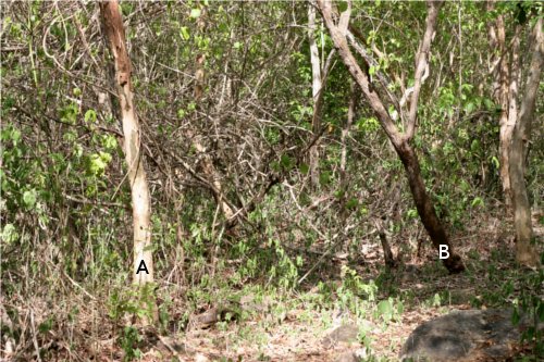
- Dry tropical forest, more or less well preserved, with high biodiversity. Not uniform. In some areas, even the older trees are only 2-4 m high (fig. 2A). In other areas, trees are much higher and bigger (fig. 2B, 3).
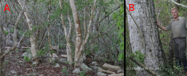
(A) Dry forest in rocky area, with 2-4 m high trees, in mountain range of Mãe-da-Lua Reserve.
(B) The biggest embiratanha (Pseudobombax marginatum) in the hills of Mãe-da-Lua Reserve.
- Mature sub-humid forest, at least in part secondary, commonly called "mata fresca" (in English: "cool forest"). Covers an area of 5-7 ha on the mountain tops, at an elevation of 600 m or more. This forest has tall and big trees, which are overgrown by lianas and epiphytes (fig. 3). Tillandsia usneoides can be seen hanging from the tree branches (photo). The "mata fresca" ressembles atlantic forest ("mata atlântica"), and I believe that it is classified as such by the environmental legislation.
- Secondary caatinga, especially in the valleys and the lower hillsides. The most common tree species here is Sabiá (Mimosa caesalpiniifolia Benth). Also areas destroyed by farming and wildfires in more recent times.

The lowlands are covered by secondary arboreal Caatinga in various stages of regrowth and recovery (fig. 4). There are extensive areas with a high biodiversity, which seem to have been undisturbed for at least 40-50 years. Other areas are less well preserved, with younger secondary growth.
